


1
2
3
4
5
6
7
8
9
10
11
12
13
14
15
16
17

Fallen Hibiscus Tree in the Forest Provides Wood for Canoe on Mejit Island
Critters on Wotho Atoll
Pandanus Leaf Harvest for Handicrafts on Wotho Atoll
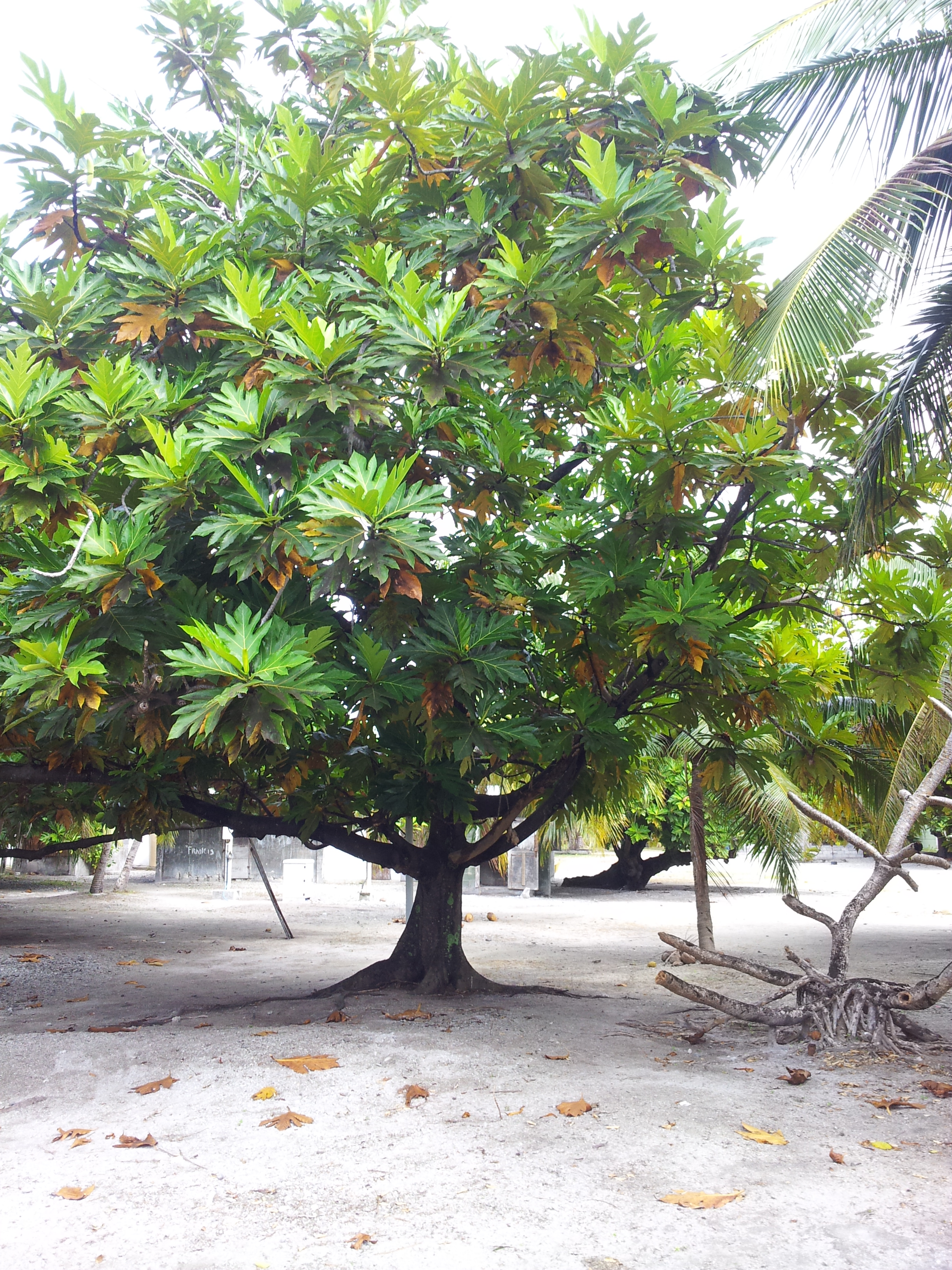
Breadfruit or Ma Tree on Wotho Atoll
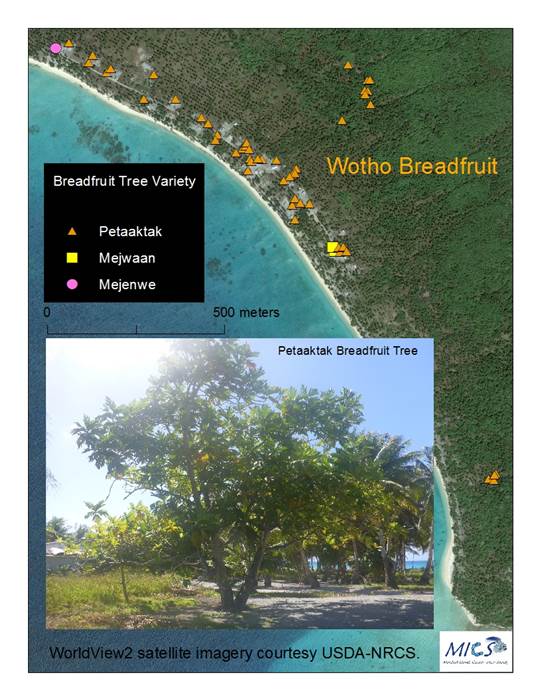
Breadfruit Tree Mapping on Wotho Atoll
Canopy Cover within the Kejbar Forest on Wotho Atoll. Kejbar Trees are Apex Forest Species Used by the Local Population for its Medicinal Properties.
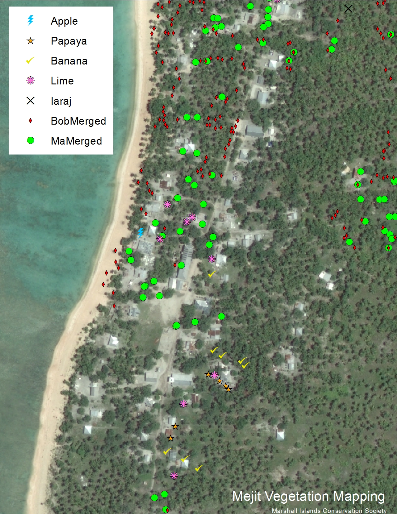
Technical Support to Local NGO Named "Voices of the Women of Mejit" in Mapping All Food Tree Species on Mejit Island
Karjo Traditional Fishing Method on Wotho Atoll
Wotho fishermen map their fishing grounds
Present and Future Fishermen Talk About Herbivore Fish Species as Nature's Lawnmowers During Coral Bleaching on Wotho Atoll
Algae Growth in Wotho Atoll
Establishing Ground Control Points for Mapping Elevation on Wotho Island as part of Climate Impact Analysis
Establishing Ground Control Points for Mapping Elevation on Wotho Island as part of Climate Impact Analysis
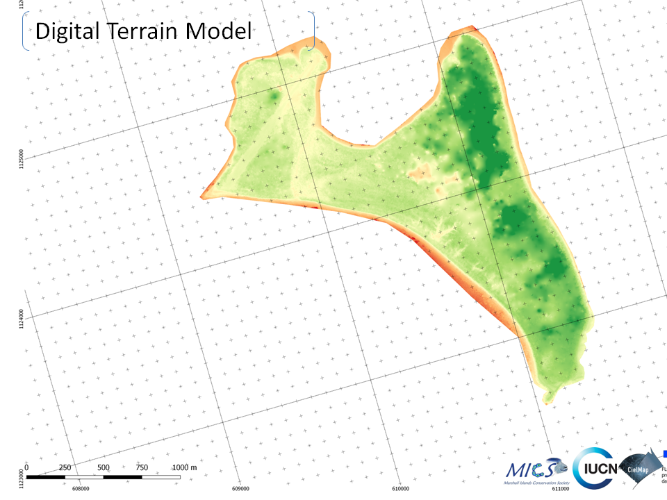
Map of Elevation on Wotho Island for Climate Impact Analysis
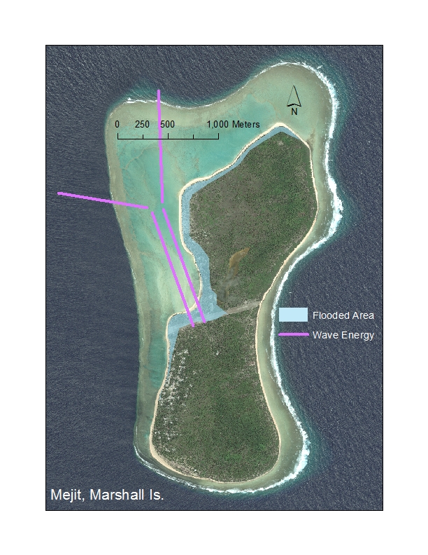
Reconstructing an Inundation Event that Occurred in Mejit Island in January 2015
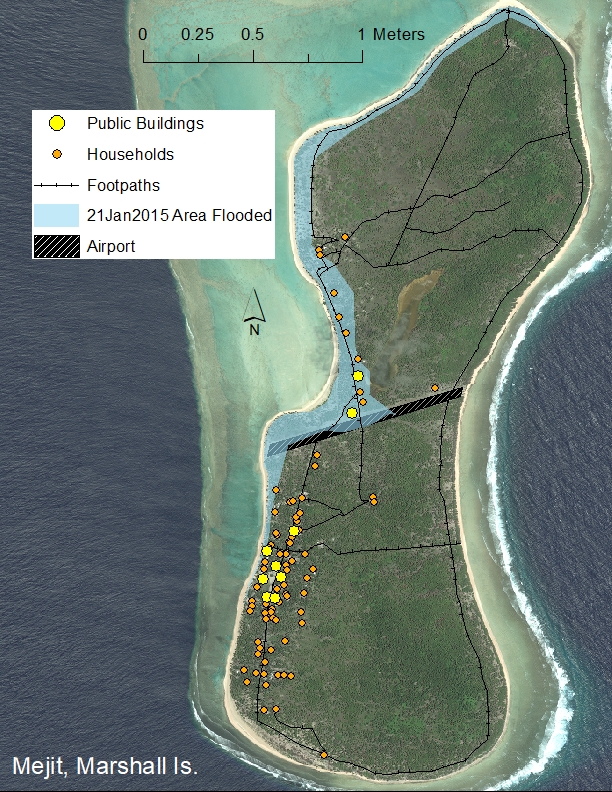
Map of the Mejit Island January 2015 Inundation
Make a one-time donation and support MICS's conservation efforts.